Gazette Notice: the cartographers have at last learned what roads are
After a period of firm instruction, the TownSquare cartographers have stopped drawing ruler-straight accusations across forests and now produce maps with proper roads.
The Town Square Gazette is pleased to report that the cartographers have completed their retraining and can now, in most cases, identify a road.
Readers may remember the previous map edition, in which every connection between towns was represented by a determined line charging across the countryside with no regard for trees, mountains, rivers, or basic decency.
Several forests were bisected. One lake was treated as a suggestion. At least three uninvolved towns found themselves with lines running directly through the middle of their public squares.
The Guild of Cartographers insisted this was "technically correct" because the towns were connected.
The rest of us insisted that if a road from Oak Hollow to Lantern Quay passes straight over a mountain, through a pond, and across somebody else's vegetable patch, it may be a connection but it is not a road.
This disagreement has now been resolved through additional training.
Readers seeking the full engineering account may consult When map lines start behaving like roads.
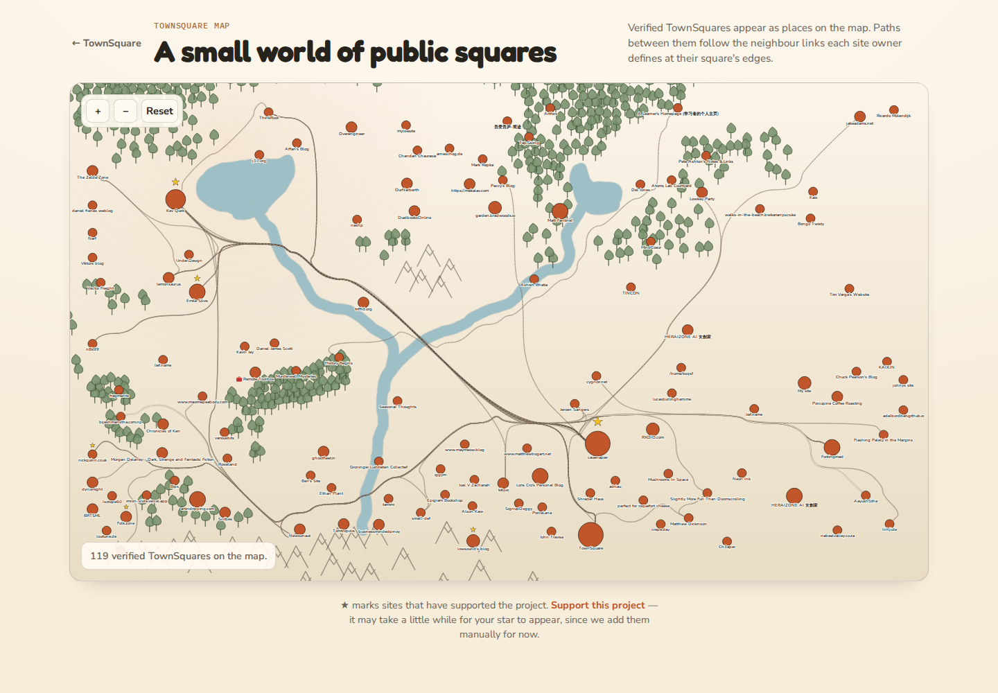 The roads have begun to show judgment.
Evidence submitted to the public
For readers who suspect the Gazette has exaggerated events, we present the record.
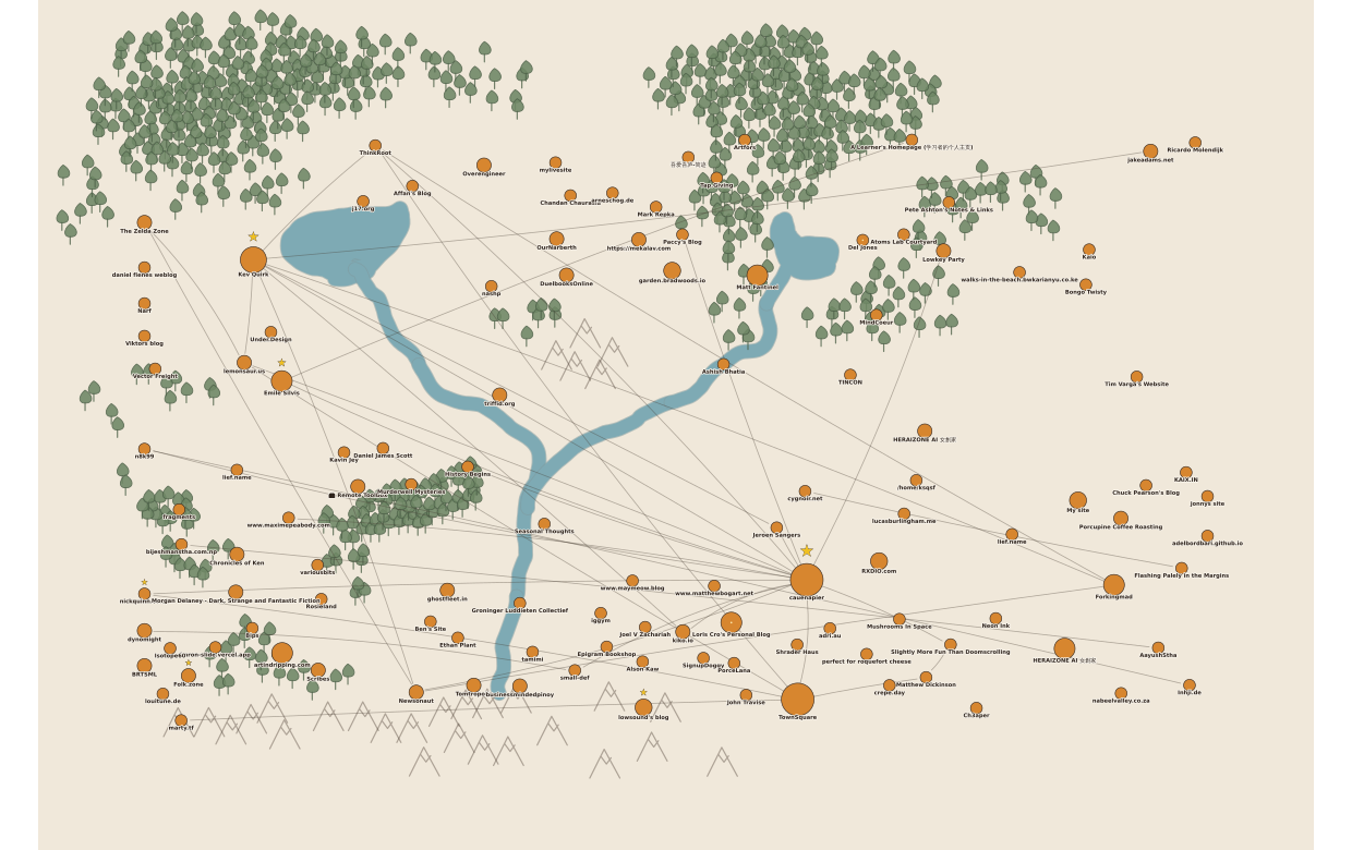 Before: the cartographers drew direct accusations across forest, water, and anyone else's property.
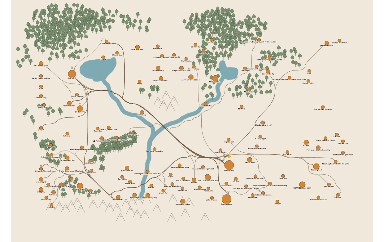 After: the roads now go around obstacles like they have met the concept of geography.
What the cartographers now understand
Roads ought to go around things
The new map no longer treats the landscape as a blank sheet waiting to be insulted.
Forests now discourage road-building. Mountains strongly discourage it. Water remains crossable, but only after the appropriate muttering and paperwork. If there is a sensible place to cross a river, the road will prefer that crossing instead of splashing through wherever it pleases.
This has produced a marked improvement in public morale.
Major routes now look important
Not every path on the map deserves the same ceremony.
Busy connections between well-travelled towns now appear as proper roads, while lesser connections look more like small local ways or trails. This means a reader can glance at the map and tell the difference between "the main way to market" and "a footpath your cousin swears is faster."
Roads may now travel together like sensible infrastructure
In earlier editions, every route behaved as though it had taken a blood oath never to share space with another road.
That policy has been relaxed. Roads can now follow similar corridors before splitting apart, which is how many real road networks behave and also how one avoids building six separate lanes through the same meadow for no reason.
The effect is not perfect yet, but it is visibly less unhinged.
A statement from the editorial board
The Gazette supports these developments. A map should feel like a place, not an argument between geometry and topsoil.
We are particularly pleased that large towns no longer have roads stabbed directly into the centre marker as if caravans are expected to arrive through the mayor's office.
The roads now stop at the town boundary like civilised guests.
Matters still under review
The retraining programme has been successful, but not complete.
The cartographers still need supervision in three areas:
- They remain a little too willing to redraw the whole road network while scenery is being edited.
- River crossings are improved, but some bridges still appear to have been chosen by optimism.
- Shared routes should eventually become truly shared road segments instead of several roads politely standing on top of one another.
Still, this is meaningful progress. The maps are more legible, the towns look less under siege, and the mountains are no longer being treated as a minor inconvenience.
Readers may inspect the public map at townsquare.cauenapier.com/map and judge the work for themselves.